LEYTE
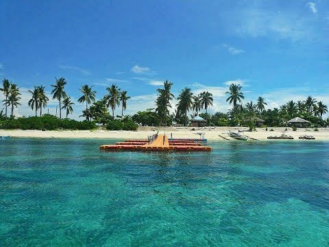
Leyte, island, one of the Visayan group in the central Philippines, lying east of Cebu and Bohol across the Camotes Sea. It lies southwest of the island of Samar, with which it is linked by a 7,093-foot (2,162-metre) bridge (completed in 1973) across the narrow San Juanico Strait. The Samar and Bohol(Mindanao) seas lie to the north and south, and Leyte Gulf occupies a large basin between eastern Leyte and southern Samar Island.
The island is irregular in shape and has a rugged mountain backbone, which reaches its maximum height at Mount Lobi (4,426 feet [1,349 metres]) in the centre. A complex system of short streams drain northward to Carigara Bay or westward to Leyte Gulf. The mountains are broken by a low gap at the narrowest part of the island, there crossed by a highway. Rolling plains are found in the coastal areas, particularly in the north near Tacloban and Ormoc.
The island was known to 16th-century Spanish explorers as Tandaya. Its population grew rapidly after 1900, especially in the Leyte and Ormoc valleys. In World War II, U.S. forces landed on Leyte (October 20, 1944), and, after the Battle of Leyte Gulf, the Japanese were expelled. Because the availability of land has been exhausted, Leyte has supplied a large number of migrants to Mindanao.
Most inhabitants are farmers. Fishing is a supplementary activity. Rice and corn (maize) are the main food crops; cash crops include coconuts, abaca, tobacco, bananas, and sugarcane. There are some manganese deposits, and sandstone and limestone are quarried in the northwest.
The island has two major cities, Ormoc and the port of Tacloban. Other population centres include Barugo, Carigara, Baybay, Burauen, and Maasin. Tacloban and Ormoc were two of the locales that were hit hardest by Super Typhoon Haiyan, a powerful tropical cyclone that swept through the central Philippines in early November 2013 and devastated large parts of Leyte and other islands. Area 2,785 square miles (7,214 square km). Pop. (2000) including smaller adjacent islands, 1,952,496; (2010) including smaller adjacent islands, 2,183,295. (https://www.britannica.com/place/Leyte)
SAMAR
 Samar, island, east-central Philippines, the third largest (after Luzon and Mindanao), part of the Visayan Islands archipelago. It lies between the Samar and Philippine seas and is separated from the Bicol Peninsula of Luzon (northwest) by the San Bernardino Strait. A bridge across the San Juanico Strait connects Samar with Leyte to the southwest. Samar lacks the high mountains that characterize most of the Visayas, but it is exceedingly hilly, with elevations generally from 500 to 1,000 feet (150 to 300 metres), culminating in Mount Capotoan (2,776 feet [846 metres]). Lowlands are restricted to a coastal fringe and to small river floodplains and deltas. The island’s rivers are generally short and flow in a radial pattern. Frequent typhoons in late summer and autumn cause considerable damage. (https://www.britannica.com/place/Samar)
PANAY
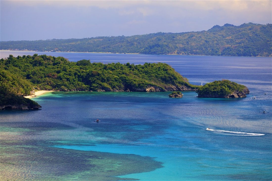 Panay, island, westernmost of the Visayan Islands, central Philippines, surrounded by the Sibuyan, Visayan, and Sulu seas; the Guimaras Strait to the southeast separates it from Negros. It is roughly triangular in shape. A rugged, almost unpopulated mountain range parallels its western coast. Between the range and a hilly eastern portion, a densely populated, intensely farmed (sugarcane, rice) plain extends for about 95 miles (155 km) from the northern to the southern coasts. A wide lowland on the southeast is formed by the deltas of the Jalaud, Jaro, and Sibalom rivers.
There are large concentrations of fishponds in the northern and eastern parts of the island, and mineral deposits include coal and copper. The inhabitants are primarily of the Hiligaynon (Ilongo) ethnolinguistic group; nomadic peoples live in the mountainous areas. Panay’s major cities are Roxasand Iloilo City. Many areas on Panay sustained heavy damage from Super Typhoon Haiyan, a powerful tropical cyclone that struck the region on November 8, 2013. Area 4,446 square miles (11,515 square km). Pop. (2000) and smaller adjacent islands, 3,503,865; (2010) and smaller adjacent islands, 4,031,636. (https://www.britannica.com/place/Panay-island-Philippines)
CEBU
 Cebu, island, central Philippines. It is the centre of Visayan-Cebuano culture and has preserved a strong Spanish tradition in its cultural life. Attracted by the island’s focal position, the Portuguese navigator Ferdinand Magellan landed there and converted the ruler and chiefs to Christianity. He later was killed on nearby Mactan Island. There are numerous relics of the event in Cebu City.
Cebu was probably the first Philippine island to cultivate corn on a widespread basis after that plant’s introduction by the Spaniards. Coarse-ground corn remains the staple food, though grain is imported from Mindanao, for Cebu is not agriculturally self-sufficient. Cebu’s manufacturing industries are limited primarily to food processing. Coal, copper, limestone, gold, and silver are mined in the central hill country of the island. In addition to Cebu City, the major settlements on Cebu are Danao, Lapu-Lapu (formerly Opon), Toledo, and Mandaue. Numerous locations in northern Cebu were severely damaged by Super Typhoon Haiyan, a powerful tropical cyclone that swept through the central Philippines in early November 2013. Area 1,707 square miles (4,422 square km). Pop. (2000) Cebu and smaller adjacent islands, 3,356,137; (2010) 4,167,320. (https://www.britannica.com/place/Cebu )

